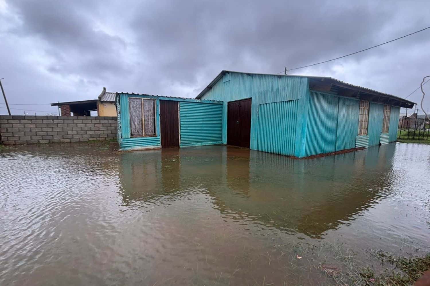
Kouga Municipality Executive Mayor Hattingh Bornman on Thursday issued an urgent call for residents in low-lying areas along the Gamtoos River to evacuate immediately, warning that the Kouga Dam has exceeded full capacity and is overflowing at an alarming rate.
“The Kouga Dam is currently at 113% and overflowing extremely fast,” Bornman said.
He added that the evacuation request is being made as a precautionary measure.
“We are asking as a precautionary measure for all people in low-lying areas on the Gamtoos River to please evacuate their residences as soon as possible.”
The municipality says its teams are already on the ground to assist anyone who needs help during the evacuation.
These are the areas under evacuation orders
The municipality has identified several communities at serious risk, particularly those situated in low-lying terrain along the Gamtoos River and its surrounding valleys.
Residents in the following areas have been specifically requested to leave their homes without delay.
- Kingsway Village,
- Big Fish,
- Gamtoos Mouth Resort, and
- The Ferry Hotel area.
“We are expecting big floods and this is a precautionary measure that we need to make sure that our residents are safe,” Bornman said.
Where to go
Two community halls have been opened to receive displaced residents.
The Katrina Felix Hall in Thornhill and the Loerie Community Hall are both available as official evacuation shelters.
“The Loerie Hall community hall as well as the Thornhill community hall will be available,” Bornman confirmed.
Meanwhile, agricultural farmers in the Gamtoos Valley are being strongly advised to act with urgency.
Authorities have called on farmers to relocate livestock, farming equipment, machinery, and vehicles to higher, safer ground to prevent severe flood damage.
Kromme River residents on standby as Impofu Dam levels rise
Beyond the Gamtoos River, Bornman has also issued a precautionary notice for residents living in low-lying areas along the Kromme River.
The Impofu Dam is currently at 65% capacity, with water levels rising rapidly, raising concern about what lies ahead if conditions continue to deteriorate.
While a formal evacuation order has not yet been issued for the area, Bornman warned that one could come within hours.
Residents have been urged to remain alert, monitor official communication channels, and prepare for a possible evacuation.
They are also advised to move valuables, vehicles, and livestock to higher ground as a precaution, and to avoid all flooded roads and river crossings.
The mayor indicated that the situation was being closely watched, with emergency teams monitoring developments on the ground.
Further updates will be communicated as conditions evolve, with a critical window identified between 12pm and 13pm during which evacuation notices may be issued if the situation worsens.
Do not cross flooded roads or rivers
Authorities emphasised that no one should attempt to cross flooded roads or rivers under any circumstances.
Emergency teams remain on high alert throughout the affected areas.
Bornman also cautioned that road information was still developing at the time of his address.
“There are various roads that are flooded and closed and we will let you know as soon as we have more details on those,” he said.
Western Cape road closures
The Western Cape Government issued a road closure update on 7 May 2026, with the Department of Infrastructure confirming widespread closures across the Garden Route District.
All closures are in effect until further notice, and motorists are reminded not to cross flooded roads under any circumstances.
The following roads are currently closed across the Garden Route District:
🚨 Garden Route District road closure update as at 6am
✅ MR401 is open
✅ Full list below⬇️ pic.twitter.com/MTeQaQKeLu– @WCGInfrastructure (@WCGov_infra) May 7, 2026
Meanwhile, the Mossel Bay Municipality on Wednesday night had also warned residents to be cautious of the closure of three roads due to flooding in multiple outlying areas of the region.
It said the following roads have been closed:
Kleinplaas Road (Great Brak River/Friemersheim/Jonkersberg) – Closed due to flooding (19:10).
Haelkraal Road (R328 Ruiterbos to R327 Herbertsdale) – Closed due to flooding of the Kouma River (16:25).
Leeukloof Road (Klein Brak River/Botlierskop area) – Closed due to flooding (19:00).