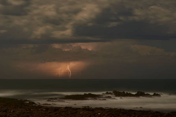
Storm, lightning and ocean with sky and weather for nature, danger and seascape at dusk. Dark, moody and cloudy with sunset horizon on coastline for winter climate, thunder and rain mockup
The South African Weather Service (Saws) has issued a yellow level 2 impact-based warning in the Western Cape, which may lead to difficulty in navigation at sea.
This follows severe weather conditions hitting the country by a storm in recent weeks, causing major damage to infrastructure and fatalities.
South Africans are slowly settling into winter; however, the weather conditions may have a different story to tell. Here’s what you should prepare for today:
Cloudy and rainy weather is expected across the country on Tuesday, with conditions likely to remain unfavourable in several areas.
Yellow level 2 warning
For Tuesday, 19 May 2026, the weather service has issued a yellow level 2 impact-based warning in the Western Cape, which may lead to difficulty in navigation at sea between Table Bay and Cape Agulhas.
Partly cloudy conditions are expected in the province, with isolated showers and thundershowers scattered across the central and eastern parts.
Fresh to strong winds are expected along the coast, blowing south-easterly to easterly, reaching gale force along the south-west coast. The Ultraviolet B (UVB) sunburn index will also be low on Tuesday.
Eastern Cape
In the Eastern Cape, a cloudy and cool climate is anticipated, with isolated showers and thundershowers scattered across the southern and western areas of the western half of the province.
Winds along the coast will be light to moderate easterly, becoming a fresh breeze and strong later in the morning.
The eastern parts of the province will experience a cloudy, cool, misty morning, with isolated showers and thundershowers south of the escarpment.
With variable wind conditions, possibly a light breeze in the morning, becoming moderate to fresh later, blowing south-easterly during the day.
Kwa-Zulu Natal
Fog patches are expected in KwaZulu-Natal in the morning and evening, with cloudiness increasing later in the evening.
During the daytime, partly cloudy conditions are expected to go from cool to warm with isolated showers and rain in the east.
Winds along the coastline will be light during the morning hours and are expected to become moderate throughout the day. The sunburn index will also be moderate.
Other provinces
Weather conditions in Gauteng are partly cloudy, cool, with isolated showers and rain. Despite this, a high UVB is expected.
In Mpumalanga, the morning fog is said to patch over the Drakensberg escarpment and places in the Lowveld. Otherwise, it will be partly cloudy and cool to warm with isolated showers and rain, except in the extreme south-eastern parts.
Limpopo will experience morning fogginess over the northern interior, with partly cloudy skies, cool, isolated showers, and rain.
Free State and North West
The Free State and North West forecast predicts partly cloudy, cool conditions with isolated thundershowers. Especially over the western parts of the Free State.
It will be cold in the southern interior of the Northern Cape, with expected cloudy weather that goes from cool to warm throughout the day. Isolated thundershowers will be scattered across the central and south-eastern parts of the province.
The weather service has noted that the wind along the coast will be between light and moderate northerly to north-westerly.
No evacuations
So far, no urgent evacuations or severe weather conditions have been predicted or documented. However, weather conditions across the country may change later in the evening depending on the region.
Residents are encouraged to remain prepared for atmospheric changes and to stay updated on the local weather system.