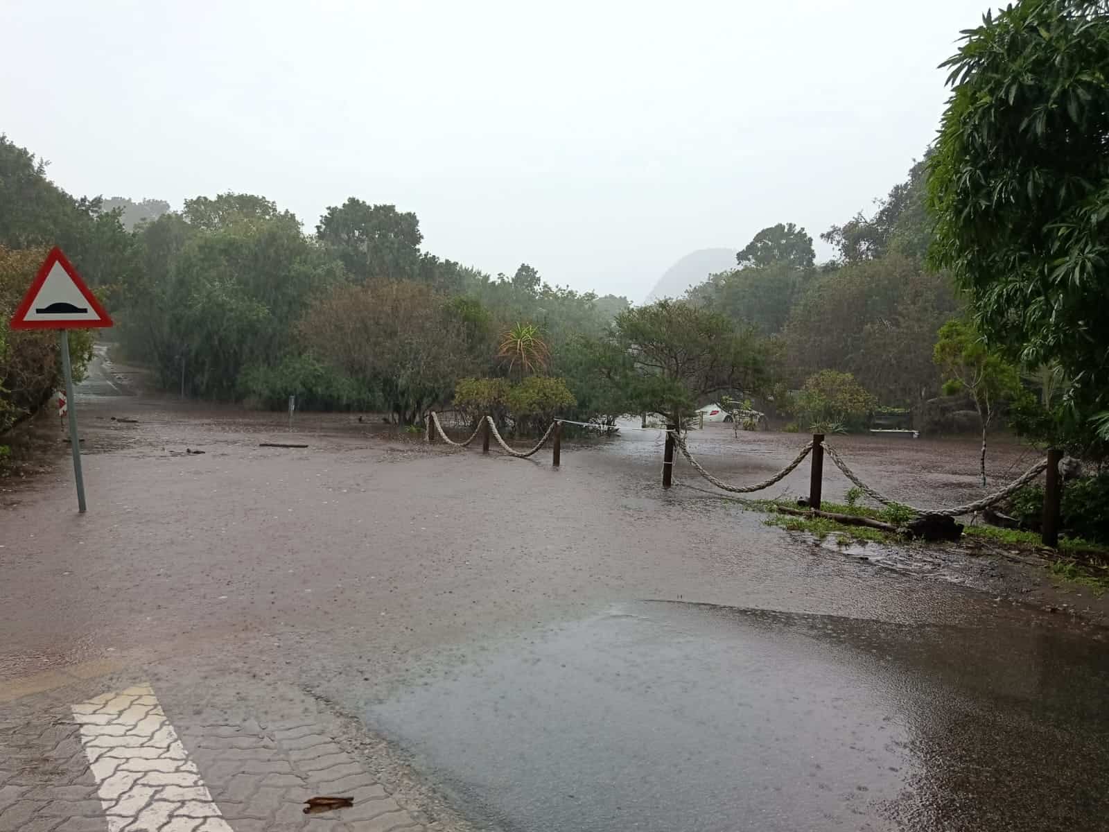
Motorists have been urged to exercise caution and find alternative routes, as ongoing severe weather has led to numerous road closures and restricted routes across the Garden Route in the Western Cape.
This is amid flood warnings and storm preparations in South Africa as a cold front swept across the country midweek, and schools in flood-prone areas were unexpectedly closed during exam week.
On Thursday, 4 June 2026, the Garden Route District Municipality reported that the Garden Route River/Dam had overflowed for the first time this year following 24 hours of persistent rainfall.
AfriGIS senior consultant and Geospatial Scientist Marna Roos said 22 communities along the Garden Route District could become completely cut off if rivers overflow and key crossings fail.
‘Residents could lose all road access’
While weather forecasts show where the heaviest rainfall is expected, the analysis revealed that residents could lose all road access if floodwaters rise.
“Our latest road connectivity analysis reveals that 22 of the Garden Route’s 209 informal settlements are at high risk of losing all physical access if key river crossings are rendered impassable during the coming Level 8 storm – becoming completely disconnected islands,” Roos said.
High Risk
Roos also noted that Kanaland and George emerge as the highest-risk municipalities, with several settlements in Zoar, Uniondale and Wilderness facing the possibility of complete isolation, should key routes become impassable.
“Kannaland and George are the most at-risk municipalities out of the 11 analysed, accounting for 16 of all high-risk settlements, with Zoar, Uniondale, and Wilderness containing multiple communities that face complete isolation.”
She added that this information would enable disaster management teams and responders to allocate the necessary resources to prepare and evacuate spaces before flooding further disrupts communities.
“By pinpointing exactly where road network access would fail first, this spatial intelligence enables disaster management teams and emergency responders to position rescue resources and plan escape routes before the floods begin,” she concluded
31 Road Closures
Motorists are urged to exercise caution and turn around to find alternative routes, as ongoing severe weather has resulted in numerous road closures and restricted routes across the Garden Route District.
Since 12pm on Thursday afternoon, the Garden Route District has recorded a total of:
- 31 road closures,
- 14 roads are partially open
- While seven roads are open to local access only
High Alert
The Western Cape Government continues to monitor the impact of the weather system affecting parts of the province, with disaster management teams, emergency services and municipalities remaining fully activated and on high alert.
According to MEC Anton Bredell, authorities remain focused on protecting communities and responding to incidents as they arise.
The Disaster Management Centre reported the closure of the N1, located at Leeu Gamka, due to flooding in the area. At this stage, there is no alternative route available.
Impact of heavy rainfall
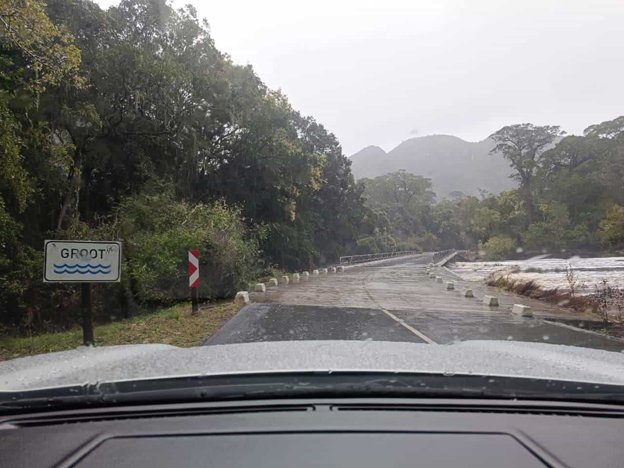
Meanwhile, the South African Weather Service (Saws) announced that dams in both the Central Karoo and Garden Route Districts are currently spilling, while rivers remain full or in flood.
The Keurbooms River is currently flowing at 133 cubic meters per second and is being closely monitored by authorities.
Eskom has also reported persistent power outages in parts of the Garden Route, including Harkerville and Covie in the Bitou municipal area, along with Sedgefield and Karatara in Knysna.
According to the Western Cape Government, Eskom and municipal teams continue to work on restoring electricity supply to affected communities.
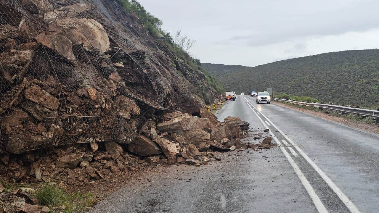
Rocky Roads
Road infrastructure has also been impacted in several areas, including Molteno Pass between Beaufort West and Loxton, which remains closed, while sections of the R328 towards the Cango Cave and Welbedacht Road in Oudtshoorn have also been closed due to weather-related damage.
Rockfalls have been reported along the R324 at the Tradouw Pass and on sections of the N12. While localised flooding was recorded in Seweweekspoort, response teams continue to closely monitor conditions.
Accommodation
Meanwhile, humanitarian assistance, including food, blankets and other essential supplies, is being coordinated where required. Emergency shelter facilities also remain available should communities require temporary accommodation.
“The situation remains stable, but conditions can change rapidly as the weather system continues to move through the affected areas.”
“We urge residents to remain vigilant, heed all warnings, and avoid taking unnecessary risks,” Bredell concluded.