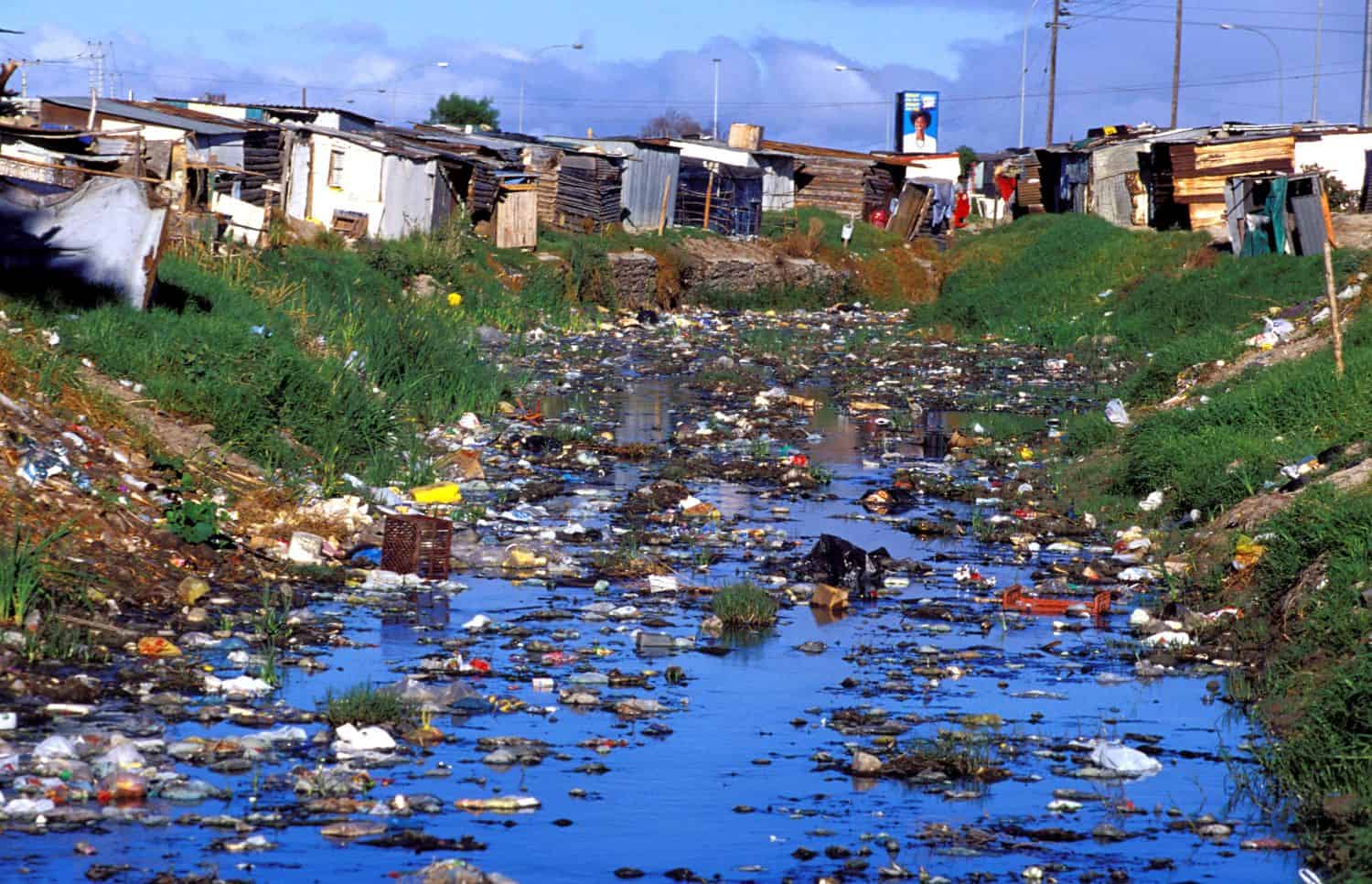
CAPE TOWN, SOUTH AFRICA - JULY 15: (.) A polluted area between shacks is seen on July 15, 2001 in Site C Khayelitsha, a township about 35 kilometers outside Cape Town, South Africa. Khayelitsha is one of the poorest and fastest growing townships in South Africa. People usually come from the rural areas in Eastern Cape province to find work as maids and laborers. Most people don't find work and the unemployment rate is very high, together with lot of violence and a growing HIV-Aids epidemic, it?s a harsh area to live in. (Photo Per-Anders Pettersson/Getty Images)
University of Cape Town researchers this week unveiled the city’s first detailed map of air pollution dangers , exposing how over 40% of residents breathe toxic air in vulnerable spots.
The work, published in GeoHealth, spotlights hotspots where dirty skies hit the poorest hardest.
Dr. Meryl Jagarnath, from UCT’s Division of Environmental Health, led the effort.
Alarming hotspots
About 1.9 million Capetonians, which is 40.3% of the population, face high to extreme risks, the study revealed.
Cape Town’s deep divides amplify the crisis, Jagarnath said. As South Africa’s most unequal city, lingering segregation herds environmental blows toward the broke and sidelined.
High-risk areas are concentrated in townships and informal settlements including Khayelitsha, Crossroads, Philippi and Gugulethu.
Jagarnath noted these are old apartheid-era areas where residents battle shoddy homes, scarce clinics and nearby pollution sources.
The method
Her crew pulled in satellite feeds from Europe’s Sentinel-5P mission, tracking killers like nitrogen dioxide from traffic exhaust, sulphur dioxide from factories, ground-level ozone and tiny particulate matter that invades lungs.
They layered this onto a custom social vulnerability index factoring in age, poverty, housing and infrastructure.
Dr. Jagarnath hailed its fresh take. She said that old-school air checks fixate on chemical counts alone and are blind to the social traps that amplify real-world harm and sickness.
She stressed the need for plans that pursue justice, not just averages.
“By making visible the spatial distribution of air pollution risk and its intersection with social vulnerability, this study provides critical evidence base for advancing environmental justice in South Africa,” she said.
Path to fixes
The maps should be used as guides to employ sharper action in advancing environmental justice in South Africa, Jagarnath urged.
“Such interventions may include reducing emissions in high-risk areas, improving housing and infrastructure, increasing access to healthcare and enhancing urban green spaces.
“By addressing both environmental exposures and underlying social conditions, these strategies have the potential to reduce health inequalities and improve overall population health.”