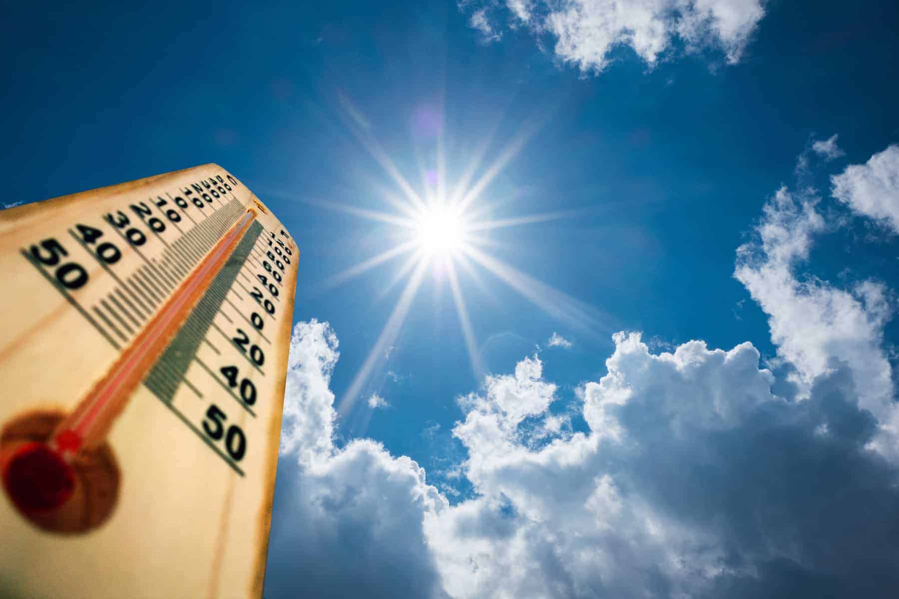
The South African Weather Service (Saws) has issued a warning for extremely high fire danger conditions over the northern part of the Namakwa District of the Northern Cape, including the Matzikama and Swartland municipalities of the Western Cape, on Monday.
“Conditions are such that the FDI index is above 75. Under these conditions, fires may develop and spread rapidly, resulting in damage to property and possible loss of human or animal life,” warned the weather service.
Very hot to extremely hot and uncomfortable conditions are expected over the western parts of the Northern Cape, the West Coast District, and vast parts of the Western Cape (except in the southern parts).
Monday’s weather forecast
Gauteng: Cloudy in the morning, otherwise partly cloudy and cool to warm weather. The expected UVB sunburn index: High.
Mpumalanga: Cloudy at first, otherwise partly cloudy and cool with light rain over the extreme north-western parts in the early morning. It will be warm over the Lowveld.
Limpopo: Cloudy at first with light rain in the south-western parts in the morning, otherwise partly cloudy and cool to warm.
ALSO READ: Level 2 warning: Severe thunderstorms, heavy rain and hail in two provinces on Sunday
North West: Cloudy in the north with morning light rain in the extreme north-east, otherwise partly cloudy and warm with isolated showers and rain in the west.
Free State: Cloudy in the extreme east at first, where it will be cool, partly cloudy and warm.
Coastal provinces
Northern Cape: Morning fog along the north coast, where it will be cool, otherwise fine and warm to hot, becoming partly cloudy from the afternoon with isolated showers and thundershowers, but scattered in the north-east. The wind along the coast will be light westerly.
Western Cape: Fine in the south, otherwise partly cloudy and warm to hot, but very hot to extremely hot weather over the interior. Isolated showers and thundershowers can be expected over the north-eastern interior in the afternoon.
The wind along the coast will be light and variable, but moderate to fresh easterly along the south coast in the morning. The expected UVB sunburn index: Extreme.
Western half of the Eastern Cape: Cloudy with morning fog in places south of the escarpment, otherwise partly cloudy and cool to warm. The wind along the coast will be fresh to strong north-easterly, but light to moderate in places in the morning.
Eastern half of the Eastern Cape: Morning fog in places over the interior, otherwise fine and hot, but warm in places along the coast. It will become partly cloudy with isolated thunderstorms in the extreme north from the afternoon.
The wind along the coast will be light to moderate north-easterly, becoming fresh to strong from late morning.
KwaZulu-Natal: Morning fog in places over the southern interior, otherwise cloudy and cool but warm along the coast with isolated showers and rain.
The wind along the coast will be light to moderate southerly to south-easterly, reaching fresh in the north at times, becoming easterly to north-easterly in the south from the afternoon. The expected UVB sunburn index: High.
READ NEXT: Does tropical cyclone Gezani pose a threat to SA? This is what you need to know