The South African Weather Service (SAWS) says while tropical storm Gezani is not a threat to South Africa, it is closely monitoring the moderate tropical storm.
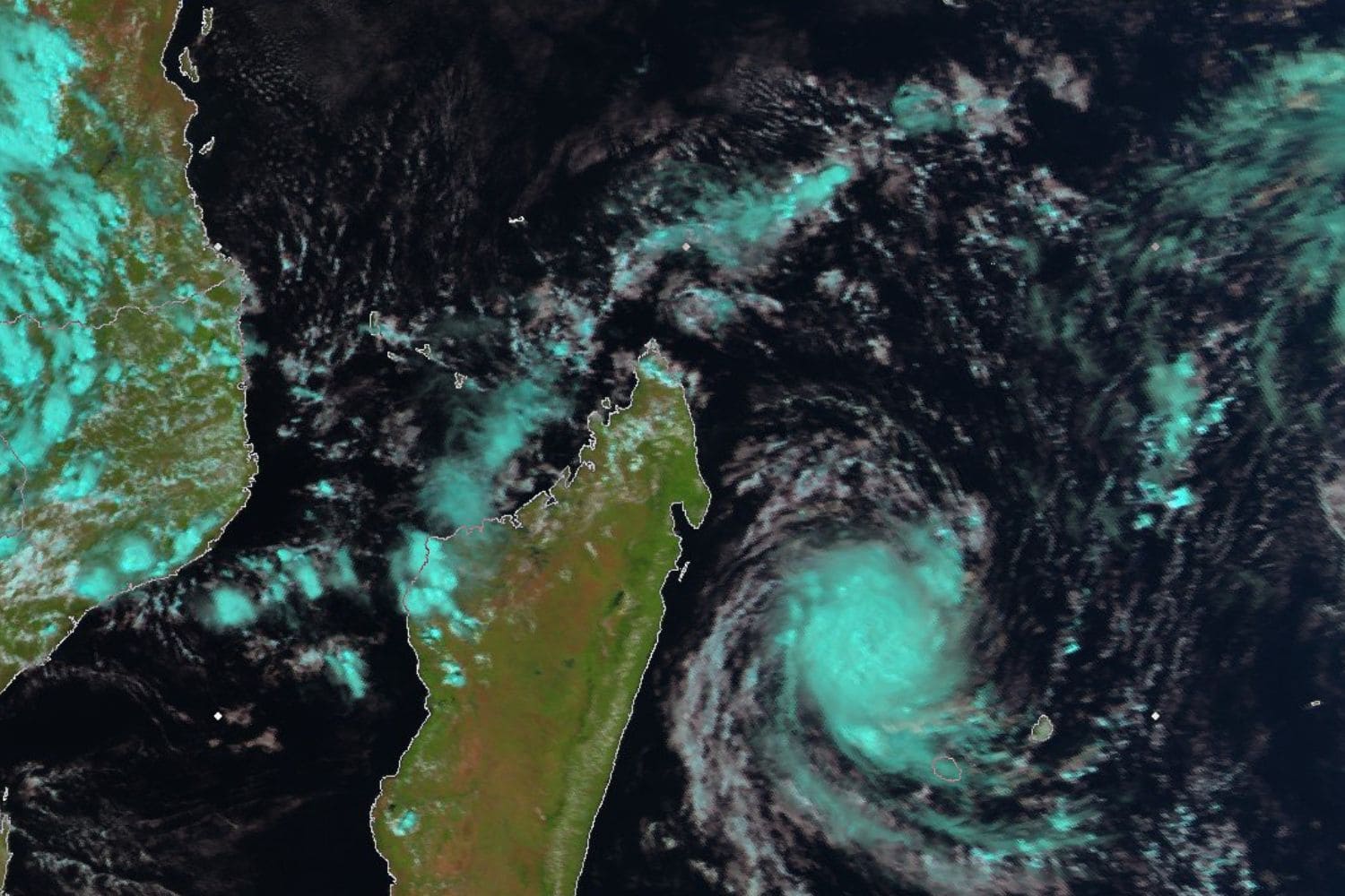
Gezani is currently located over the south-west Indian Ocean to the east of Madagascar.
Gezani
The name Gezani, contributed by South Africa, marks the seventh named system of the 2025/26 south-west Indian Ocean cyclone season.
“At present, there is no indication of any direct threat to South Africa,” the forecaster said.
“Gezani is currently moving westward under favourable environmental conditions, and forecast guidance indicates that landfall over eastern Madagascar is likely on Tuesday afternoon, 10 February 2026.”
ALSO READ: What’s up with the weather? KZN residents warned of severe thunderstorms after heatwave
Mozambique
Saw said that as the system approaches Madagascar, environmental conditions may support further intensification, and Gezani could strengthen into a tropical cyclone, or possibly an intense tropical cyclone, before landfall.
“Following landfall, the system is expected to weaken while tracking south-westward across Madagascar.”
According to Saws, Gezani is forecast to enter the Mozambique Channel late on Wednesday, 11 February 2026, where environmental conditions may once again become favourable for re-intensification.
“Some forecast scenarios suggest a possible approach toward the Mozambique coast later in the week; however, uncertainty remains regarding the exact track and intensity during this phase.”
Warning
Saws has warned marine vessels to take precautions.
“The Saws advises vessels operating in or transiting through the south-west Indian Ocean and the Mozambique Channel, as well as offshore marine operations, to exercise caution, as rough seas, strong winds, and hazardous marine conditions are expected in the vicinity of the storm.”
Thunderstorms
Meanwhile, thunderstorms are expected in parts of the Northern Cape, North West, Free State, KwaZulu-Natal and the Eastern Cape on Tuesday, 10 February.
Saws also warned of fire danger in the Northern Cape and KwaZulu-Natal (KZN).
Alerts
The forecaster issued a yellow level 2 warning for severe thunderstorms in the north eastern parts of the Northern Cape; western parts of the North West and Free State; the southern parts of KZN; and the Eastern Cape, except in the southwest.
This could lead to localised flooding and widespread small hail.
Saws also warned of hot and humid weather resulting in extremely uncomfortable conditions in places along the Eastern Cape’s south coast and adjacent interior, as well as the eastern parts of KZN.
ALSO READ: SA Weather Service debunks reports of storm Baron to devastate SA