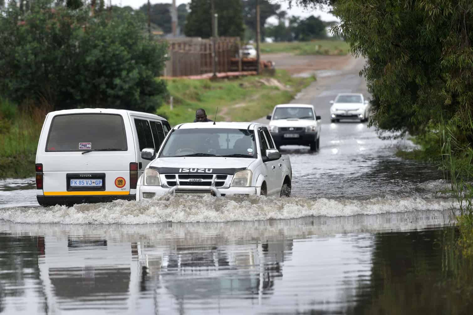
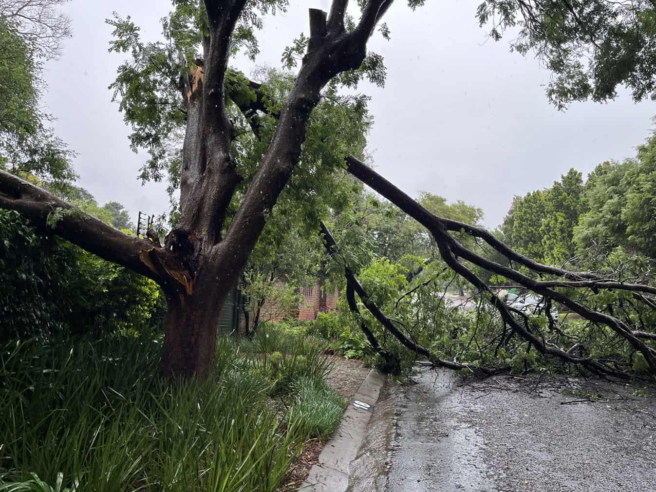
With multiple reports of floods and fallen trees from an orange level 9 storm over the interior of the country, experts warn more severe storms are predicted next weekend.
Emergency workers had their hands full with various incidents from fallen trees in Roodepoort, bridges flooding in Boksburg and an overturned bakkie in the Apies River in Pretoria as heavy downpours continued.
As much as 72mm fell in parts of the Vaal and 170mm was recorded from Friday to Sunday morning in parts of the northern Free State.
More rain expected
Vox weather meteorologist Michelle Cordier said the heavy rain at the weekend was due to a low pressure system that developed west of Namibia on Friday.
She warned that some models indicated more than 100mm of rain in parts of Gauteng, the highveld and northern KwaZulu-Natal.
“Although we do not expect 100mm everywhere, the eastern North West, the Limpopo bushveld, the Mpumalanga highveld, Gauteng, the northern Free State and central to northern parts of KwaZulu-Natal should receive at least 50mm of rain,” she said.
ALSO READ: Floods, fallen trees and power lines down: Rain wreaks havoc in Gauteng [VIDEO]
By Monday, a few showers are possible over the Free State, Gauteng, North West and KwaZulu-Natal, but parts of Limpopo will still get heavy rain.
The Weather Hooligan, Juandre Vorster, said moderate thunderstorms can be expected throughout the week, with severe thunderstorms expected on Thursday and Friday in Gauteng. Vorster predicted a level 2 storm warning for Thursday and Friday.
South African Weather Service senior forecaster Lehlohonolo Thobela said a 30% chance of showers and thundershowers was expected in KwaZulu-Natal, Free State and Gauteng on Tuesday, with temperatures starting to improve for the central and eastern parts of the country.
Wettest October in recent history
Last week, the service announced that parts of South Africa experienced one of the wettest Octobers in recent years, with parts reporting double and triple the average rainfall.
Lichtenburg in the North West’s average October rainfall of 50.43mm was surpassed by 243.2mm last month, while Thabazimbi in Limpopo measured 101mm last month, versus the average October rainfall of 26.25mm. Barberton recorded 120mm versus an average of 28mm rainfall for the period.
“October marks the start of the rainy season for South Africa’s summer rainfall regions and this year the month brought above-average rainfall to several areas.
“For some locations, October ranked among the wettest in recent history. Several measuring stations recorded rainfall totals that far exceed their long-term averages, with some reporting more than four times their average October rainfall.
“While a large part of the country experienced below-normal rainfall, there were still some stations that had their wettest October over the last 31 years.”
According to the weather service, the data illustrates that last month was one of the wettest Octobers on record, with extreme rainfall events affecting multiple provinces, particularly over the summer rainfall region.
However, in contrast, the western and northwestern parts of the country remained relatively dry, with totals mostly below 50mm.
The outlook for the remainder of summer is an enhanced probability of above-average rainfall through the bulk of the central and eastern parts of the country.
READ NEXT: More rain expected in parts of South Africa on Monday