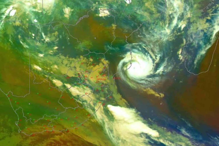
The South African Weather Service (Saws) has issued a yellow level 2 warning for severe thunderstorms, with heavy downpours, large amounts of small hail, possible strong damaging winds and excessive lightning on Sunday.
Residents in the Western Bushveld of Limpopo and the extreme eastern parts of the North West will be affected.
The weather service has also issued a yellow level 4 warning for damaging winds and waves in northern KwaZulu-Natal.
Extremely high fire danger conditions are expected over the Kamiesberg and Hantam municipalities of the Northern Cape, the Matzikama, Cederberg, Witzenberg and Prins Albert municipalities of the Western Cape.
ALSO READ: Rain and love in the air: Here’s what weather to expect on Valentine’s Day
Furthermore, hot and uncomfortable conditions are expected over the western parts of the Northern Cape, the West Coast District, the City of Cape Town and the western parts of the Cape Winelands on Sunday and Monday.
Sunday’s weather forecast
Gauteng: Cloudy and cool weather with isolated showers and thundershowers. The expected UVB sunburn index: Low 2.
Mpumalanga: Morning fog patches in places along the escarpment, otherwise cloudy and cold to cool with isolated showers and thundershowers.
Limpopo: Cloudy and cool to warm weather with isolated showers and thundershowers, but scattered in the west and central parts.
ALSO READ: Cold winter forecast debated after extreme summer weather
North West: Cloudy and warm to hot weather, with isolated showers and thundershowers.
Free State: Partly cloudy and warm, but cloudy in the east with isolated showers and thundershowers in the east and north-eastern parts.
Coastal provinces
Eastern parts of the Northern Cape: Fine to partly cloudy and warm to hot weather, with isolated showers and thundershowers in the north.
Northern Cape: Partly cloudy in the east and central areas, where isolated showers and thundershowers can be expected in places, otherwise fine and warm to hot, but very hot in places over the south-west coast. The wind along the coast will be fresh to strong southerly to south-easterly.
Western Cape: Fine and warm to hot but very hot in places over the west coast and western parts of the Cape Winelands districts, but cool in places along the south coast and the Cape Peninsula.
The wind along the coast will be light to moderate southerly along the west coast in the morning, otherwise fresh to strong easterly to south-easterly, reaching gale along the south-west coast at times. The expected UVB sunburn index: Extreme.
Western half of the Eastern Cape: Fine weather in the west, otherwise partly cloudy and warm but cloudy along the coast. The wind along the coast will be moderate to fresh easterly, becoming north-easterly by the evening.
Eastern half of the Eastern Cape: Morning fog in places, otherwise partly cloudy, cool to warm with isolated showers and rain in the east. The wind along the coast will be light to moderate easterly, becoming north-easterly in the evening.
KwaZulu-Natal: Morning fog patches in places in the interior, otherwise cloudy and cool to warm with isolated showers and thundershowers.
The wind along the coast will be light to moderate north-easterly south of Durban, otherwise southerly to south-easterly. The expected UVB sunburn index: Low.